Below is the UKHO large scale chart of the Scillies, with green showing where the bottom is exposed at low spring tides. With careful tide calculations it is straightforward moving between the islands, though you have to be mindful of dangerous rocks scattered around the flats.
The old pilot books for the Scillies, one of which we have, give many complicated bearing lines for finding your way around using pairs of landmarks, which are still very useful to know.

A chartplotter helps nowadays, up to a point. Our main plotter uses C-Map, which has proved extremely accurate in two cruises around England, Ireland and Scotland, so we have confidence in it (much less so in our backup Navionics). But as a rule of thumb, we don’t rely on it when the accuracy required – eg between two reefs – is better than plus or minus a hundred meters or so, just in case the underlying charts are wrong, a rock has been missed on them or there are problems with satellite signals.
In the Scillies, we used a combination of plotter, compass bearings and leading lines and especially good old fashioned eyeballing, to move around; wherever there were doubts about the position of rocks, someone went up to the bow and kept watch, because the water is clear and shallow, and rocks show themselves through changes in colour and disturbances in the tide.
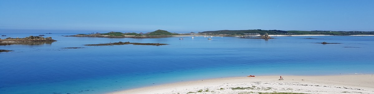
Regular visitors find and use all sorts of obscure anchorages around the Scillies, but it takes time to learn them and we were pleased enough to visit six good ones after we left the main harbour at Hugh Town, and stay overnight in four of them. Caution and inexperience of the islands dictated that we moved around about two hours before high tide to just after high tide, not wanting to risk getting stuck on a falling tide, though it was neaps so the range was small and the currents relatively slow.
We arrived from Plymouth from the east, entering by St Mary’s Sound and then round to the north-west side of the island, the biggest, where the main harbour, Hugh Town, is found. We found a vacant visitor’s buoy in St Mary’s Pool.


From Hugh Town, we found our way across Tresco Flats to New Grimsby Harbour for a night, a much less intimidating route than it looks on the chart, with two helpful beacons marking the most dangerous obstacles. Then ashore to spend time walking around the island.
The next day we went through New Grimsby Sound, then round the north end of Tresco into Old Grimsby Sound and its Harbour, and we spent more time walking, eating and shopping for supplies ashore in the well-stocked Coop.


After a night on a buoy, we moved south-east, past Peashopper Island, and turned east through a gap and north-west around the reefs to St Helen’s Pool, a relatively safe and deep water anchorage south of the island of the same name. Sailing ships used to shelter here from storms.
Deciding not to stop there, we went through St Helen’s Gap and past the north side of Tean island and down into Tean Sound, between Tean and St Martin’s, where we anchored for the night in a strong current. By luck, we found a sandy patch, though the pilot book warns that there are a lot of rocks and holding can be bad. We used our largest scale charts and signs on the shore to keep away from the multiple power cables that cross there.

The next day we retraced our movements to St Helen’s Pool, but decided not to anchor for lunch and instead motored south across the flats towards St Mary’s. We tried to use the line across the flats (Man-a-Vaur island lined up with the St Helen’s landing cairn, as in the chart) but could not see the cairn even with binoculars. We relied instead in a good look out and the chartplotter.
We then turned west to St Agnes, crossing the shallow Crow Bar – since it was high tide – and went through St Mary’s Road to St Agnes, where we initially went to the north-facing anchorage, Porth Conger, because south-west winds were forecast.

However, we found an Atlantic swell, originating probably a long way away, was refracting round the north of the island into the mouth of the bay, so we motored round the island of Gugh – connected to St Agnes by a sandbar that dries at low tide – where we found a good anchorage for the night in The Cove, which is between the two islands. We went ashore for a walk and dinner in the Old Turks Head.
Do not, by the way, ever try landing your dinghy on the sandy beach by the Boat House beacon, though it looks nearer – you’ll never get off it at low tide because by then it is then just a mess of big boulders. Always go up to the sand bar in your dinghy.


That was the only cold, damp evening we experienced in the Scillies. St Agnes, the smallest inhabited island, is very pretty but did not look its best. At least the sun came back the next morning before we left for Penzance.
