Updated April 2025
Small craft electronic navigation must be as robust as possible. So I’ve been taking a look at some useful basic principles which can be adapted from the commercial world, which has been getting to grips with paperless navigation for 30 years.
I’ve heard a lot about how it was done in the old days from Tony, the former merchant navy skipper with whom I share Spring Fever. He started out when sextant sights were a daily routine on the bridge and the second officer spent days after leaving port correcting charts.
From a yacht perspective, I was writing about the future of navigation in the late 1980s – see this post written recently when I stumbled across some of my old articles for the Guardian, Observer and Independent in a yellowing file. What’s happened in more than three decades since is a real revolution.
Small craft must get it right over the next few years, because the UKHO has signalled that its Admiralty brand paper charts will be phased out once adequate electronic replacements are available. (Recently they’ve stopped putting a target date on it). Imray paper charts, which were to disappear after the end of this year, seem to have been reprieved by a deal with an Austrian cartography firm, but that’s not nearly enough to reverse the long-term trend towards entirely electronic yacht navigation.
The quality of what are loosely known as leisure electronic charts is also vital for many small commercial craft, which cannot afford full commercial ship systems.
Events have been moving fast, so this article collects and updates earlier posts (see Electronic Navigation in the subject list). The focus is on coastal and short offshore yacht passages, up to a couple of hundred miles, not ocean sailing.
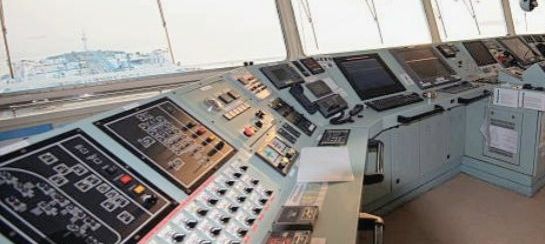
(1) Large commercial ships have completely independent back up navigation systems with their own power sources.
It is straightforward and not very expensive to achieve safe and reliable backup to the main chartplotter on a yacht, whether it’s a conventional marine instrument or software such as OpenCPN on a laptop.
The cheapest and most robust way to organise backup is to use a couple of tablets plus personal phones running chart apps such as Navionics or C-Map. For those who already navigate by tablet, backup tablets are the answer, plus a phone.
To reinforce the backup function, power banks for tablets and phones will keep you independent of the boat’s batteries in a major electrical breakdown, or an engine failure that prevents you charging the main batteries.
While tablets are widely accepted as useful on a boat, lots of authorities, including the Royal Yachting Association and the Royal Institute of Navigation’s current book on electronic navigation, will tell you that phones are too inaccurate to be used for navigation at sea.
They are out of date. Modern top of the range mobiles are not only highly water resistant (1.5 metres submersion for 30 minutes is typical), they can also give accurate positions in single figure meters anywhere at sea.
They have several disadvantages, so I do not think they should be used routinely for navigation. But as a last ditch backup – one that can also be pocketed and taken into a liferaft – they are invaluable.
Yes, there are extreme circumstances at sea – fire, flooding – but they are as likely to turn a paper chart into a soggy or charred heap as prevent an armoured and waterproof industrial-style tablet from functioning. Spare batteries in waterproof bags or cases are also extremely robust.
A fair question to ask is ‘What about lightning strikes?’ We had one on a previous boat in Suffolk, luckily while we were ashore. The only serious damage it did was to burn out all our navigation equipment, which the insurers replaced. Since then, I haven’t read a better answer to this problem than to put one of your tablets or phones into the oven in a thunderstorm. It will be protected by the oven’s metal cage. Just don’t forget it’s there!
Reliable tablets good enough for navigation can be bought very cheaply because they don’t need the big memories and super-fast speeds of top of the range consumer models – a good place to look for second-hand devices is on Back Market. See note at the end of this article for the Spring Fever setup, an example of what can be done on a tight budget.
One final thought on this issue: it would help if the Royal Yachting Association drew up standard guidance for safe backup of electronic navigation devices on the paper-free yachts of the future.
(2) Ship navigators are trained in electronic navigation to a high level, and they have regular refreshers.
For small craft, there’s a long way to go, but it is achievable. The underlying problem is that official RYA training has been hopeless for years on electronic charts and has been struggling to catch up. The organisation was caught out by the UK Hydrographic Office announcement that paper chart production under the Admiralty brand would end next year, though the outcry has led the UKHO to postpone.
I did not realise how poor the RYA had been at teaching modern navigation until the research I did to update Adlard Coles’ ‘Pass Your Yachtmaster’ and ‘Pass Your Day Skipper’ a few years ago. Better to get it right late than never, so they’re now overhauling their methods. To see a good clue to how the RYA navigation syllabus could have been restructured many years ago alongside still-important traditional navigation methods, see Stress Free Navigation by Duncan Wells.
An important feature of professional paperless navigation is regular refreshers and updates for the deck officers. If the RYA got its act together on this, it would be offering something similar for leisure sailors.
There are two good reasons for a switch of RYA policy: technology is developing all the time, but also not everybody is adept at handling it, so refresher courses for otherwise experienced sailors would be useful.
The core problem is that the RYA has been fighting a rearguard action to keep paper’s prime position on the chart table, with electronics treated as a backup aid, when it should have switched the emphasis round at least decade ago. The most important navigation skill for most experienced sailors is electronic, and paper is the backup – though one it’s important to be familiar with it as a last resort (see below).
(3) It is important to have backup sea-level position finding skills and equipment, because satnav is increasingly prone to disruption.
We used to worry about rare events like coronal mass ejections from the sun (superflares that could knock out satellites for days), atmospheric effects, signal reflections and equipment failures. Now we have to factor in the rapid recent spread of deliberate jamming and spoofing of satellite signals. Spoofing is where instruments can be fooled into showing a wrong position. Countering these problems is already a high technical and training priority for the aviation industry.
This is the area where the RYA has got it right in its training programmes, through its insistence on keeping traditional navigation in the syllabus (though too prominently- see above).
Small boats do not usually carry inertial navigation and related equipment, which on ships continue to plot a track in the absence of reliable signals from satellites. But on paperless yachts, we could deal with the new world if plotter software made it easy to draw lines for courses, bearings, fixes etc on electronic displays – in other words, use all the techniques of the pencil and paper era to plot manually on a screen if there is no satellite position. Manufacturers should make these features available.
Those who attended a recent Royal Institute of Navigation webinar will have seen that spoofing and jamming has spread in the last two years from the eastern Med and the Middle East through the Black Sea, Ukraine and eastern Europe to the Baltic states and is creeping westwards.
The unreliability of satellite positions and time signals is now a serious issue for commercial aircraft. (RIN small craft group members can see the video of the webinar online).
The disruptive technology is cheap and commonplace. This means that it is feasible for the Russians and others to make themselves a nuisance, from a distance, all over western europe, for ships as well as planes. They already do this through covert attacks against IT infrastructure and undersea cables, and also the manipulation of social media.
The increasing vulnerability of satellite navigation is why British government investment is going into the infrastructure for a digital version of the old Loran radio position-finding system, because it can be used as a ground-based backup.
Civil aviation is feeling the effects of interference with navigation, but merchant ships were early targets of spoofing years ago; in fact, jamming and spoofing have long been key areas of electronic cold and hot warfare. Spoofing of a cruder technical kind was employed by the British in WW2 to interfere with German radio navigation beams used by bombers; they could distort the broadcast flightpaths so the planes would drop their bombs at sea.
(4) Charts for a ship’s ECDIS (Electronic Chart Display and Information System) must be produced to a rigorous and internationally agreed set of standards, which are currently in the process of upgrading again to a new International Hydrographic Organisation level called S101.
It so happens that a plain UKHO paper chart is the only UK chart of any kind available to small craft at a budget price that has international approval for navigation. All the electronic charts we use from Navionics, C-Map and the rest do not meet that standard, which is why they carry the warning ‘not to be used for navigation’ (producing the ridiculous situation that we have to ignore official advice).
The UKHO no longer prints paper charts itself. Instead, private firms access data files created by the UKHO and print out charts for customers on demand.
These data files are also used to produce electronic versions of paper charts, which look exactly like their paper equivalents. (The days are long gone when this was done by scanning actual paper charts). This type of electronic product is called a raster chart and, like its paper equivalent, it is a single layer image, but on a screen. Surprisingly, though they look like official paper charts, they are not approved for navigation.
The underlying database from which the files are produced both for printing paper charts and for making raster equivalents is actually designed to facilitate the production of a different product called a vector chart. These are much more complex and come with what look to the user like multiple layers, displaying increasing detail as you go down them.
Vector charts are a mainstay of commercial shipping worldwide and a much more profitable product for the UKHO than on-demand printing of paper charts and supplying data for their electronic raster equivalents.
Commercially produced leisure charts from Navionic, C-Map and others are simplified vector charts, produced to lower standards than the fully functional ECDIS chart for ships.
The UKHO’s plan is to save the cost of converting vector database information into the format required for paper and raster electronic charts, to concentrate on its mainstream vector products.
However, after announcing 2026 for the end of paper charts, then retreating to 2030, the UKHO has now dropped specific dates and – backtracking rapidly after loud protests – says it has a commitment to leave no one behind in the transition to digital navigation: “We will continue to provide an Admiralty paper chart service that supports the needs of mariners who rely on them during the transition period.”
So what’s the solution? A working group set up by the Royal Institute of Navigation, with the Marine and Coastguard Agency a key member, plus others such as the Cruising Association, is seeking agreement on improvements to leisure electronic charts. The group has reached the stage of drafting new chart data standards. The hope is that they can be internationally approved for small craft at some lower level than ECDIS. The legal warning not to use them for navigation could then be removed.
The UKHO, along with its overseas equivalents, is now looking at producing a simplified, lower cost form of approved electronic chart for small craft which would be sold under a different generic name. But the indications are that they will still be too expensive for many small craft, even if they satisfy some modest-sized commercial craft that cannot justify the high cost of ECDIS.
The UKHO may come up with a genuine low-budget solution, or Navionics and the rest may agree to adopt a new standard, or both may happen. If nothing is done, on cost grounds alone yachts may end up sticking indefinitely with electronic charts that are not legally approved for navigation.
In the USA, the national hydrographic office continues to produce data in a form that private publishers can use to print paper charts on demand, or make available as electronic raster charts. Perhaps the UKHO, also a public body, can be persuaded to continue doing the same, rather than prioritising profitability in its commercial shipping business above the needs of small commercial and leisure craft.
(5) Among the mandatory features of ECDIS are easily accessible measures of accuracy in different areas, a more sophisticated version of the panels on UKHO printed charts which tell us when an area was last surveyed. There are still UK inshore areas last checked in the 19th century by leadline.
ECDIS gives a score for reliability, which depends to a great extent on the quality and age of the marine surveys from which the data is derived. Most leisure electronics charts do not give reliability information. It can be found on official UKHO paper charts, which have sketch plans showing the date of all the different surveys covering the chart area.
In the West of Scotland small craft can stray very quickly from a place marked as surveyed recently – for example the approaches to Oban Bay – into one last surveyed by leadline 150 years ago, where you should be exercising extreme caution. Many rocks and other features were missed in leadline surveys, as modern Antares charts now demonstrate for the west of Scotland. Seabed contours change over time in some areas, rapidly in places like the Thames Estuary swatchways. Yet on leisure electronics charts the graphics look the same, however old the survey.
At the moment, there is a good electronic workaround: you can buy raster electronic charts for tablets and laptops from the likes of VMH which look identical to UKHO paper charts, and which include the survey dates. But these products may disappear eventually, along with paper charts. In any case, they still carry the not for navigation warning, so despite their source they are still not official charts .
The solutions are discussed in (4) above.
(6) Finally, ship equipment can be switched to a single international standard procedure, so that navigators unfamiliar with the bridge can cope in an emergency.
The difficulty of persuading leisure equipment makers to do this was one of the RYA’s excuses for the backward state of its electronic chart training. I don’t believe this is a make or break issue for training or for practical small yacht navigation, though it would certainly be useful for crew unfamiliar with a boat, and particularly for small commercial craft and yacht charterers.
Note: Spring Fever’s back up charting
We use two tablets, a standard 10 inch Samsung and a water and shock proof Samsung Active 2. Both have inbuilt satellite aerials and are kept mounted securely at the chart table, fully charged all the time.
The Active 2 can be taken to the cockpit, and is particularly useful for Antares charts in Scottish anchorages, mounted temporarily next to the main chartplotter.
The larger Samsung’s routes can be synced with those on our Raymarine cockpit plotter (though our budget model requires transfer via a physical SD card rather than wifi.) We can check at the chart table what the cockpit plotter is showing.
The big tablet has Navionics plus Memory Map UKHO charts for the whole of the UK and Ireland. The Active 2 has Antares plus Memory Map, which seem to work better as a pair than Antares and VMH. (Away from Scotland we prefer VMH for its navigation features and because it offers charts down to Gibraltar – Memory Map is UK only).
The third backup is a waterproof Samsung 20+ phone in a tough case, with the Navionics chart app.
The tablets were both second hand: £120 for a nearly new Samsung 10 inch on Back Market and £80 for the Active 2 on Amazon. The phone is my personal one, top of the range when new 3 years ago. Its internal measure of satellite radius of error is generally in single figure meters at sea. I found a Canadian research paper from a few years back that said the error reading on a (now very old) Samsung S7 phone was larger than the actual number which, with an unobstructed view, was found even then to be in low single figures. With Apple the reverse was true – errors were bigger than the phone showed.
Finally, we have multiple powerpacks that will keep the tablets and phones on board going for several days, if used carefully and one at a time.
Summary: total cost of basic Raymarine cockpit plotter bought ex-display plus two tablets was £600. The phone I don’t count because I have it anyway. Navionics, Memory Map, VMH and Antares charts were at their standard prices, costing less than £200 a year to renew. There are usually at least four batteries of 20,000 milliwatts capacity each on board and the powerpack for emergency engine starting ( Halfords, £90) can also be used to charge a tablet.
