
25 miles to Tory, Ireland’s remotest inhabited island, which has an unaccountably large number of Rodgers living there. I read that in an on-line search for possible Rodgers ancestry in Ireland, though the family evidence is for connections to County Cork, not Donegal.
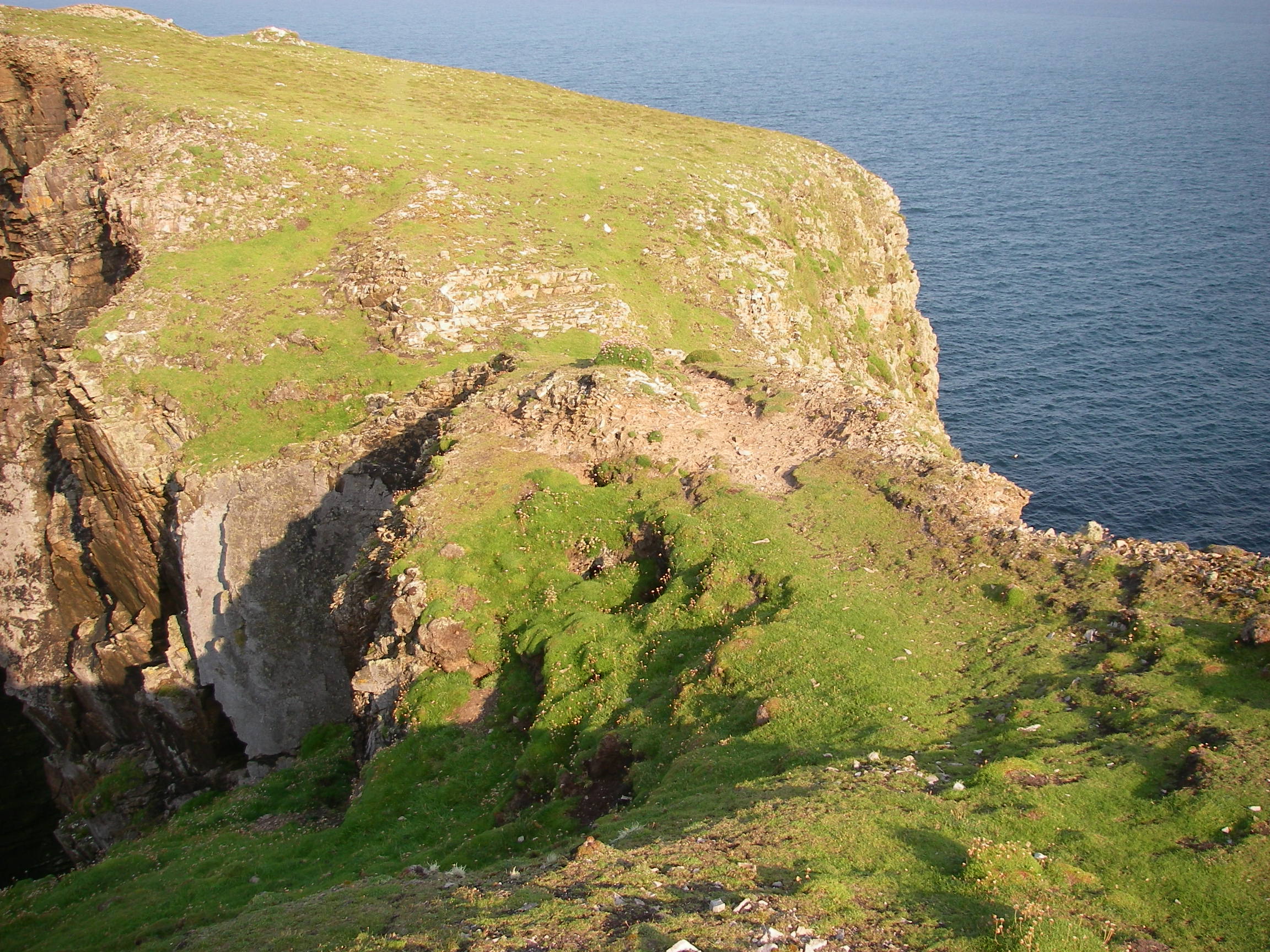
Left Port Salon at 0730 in bright sun and a southeasterly which backed north east. Brilliant blue sky, could have been in the Mediterranean apart from the sea temperature. Admired the wonderful coastline of north-east Donegal.
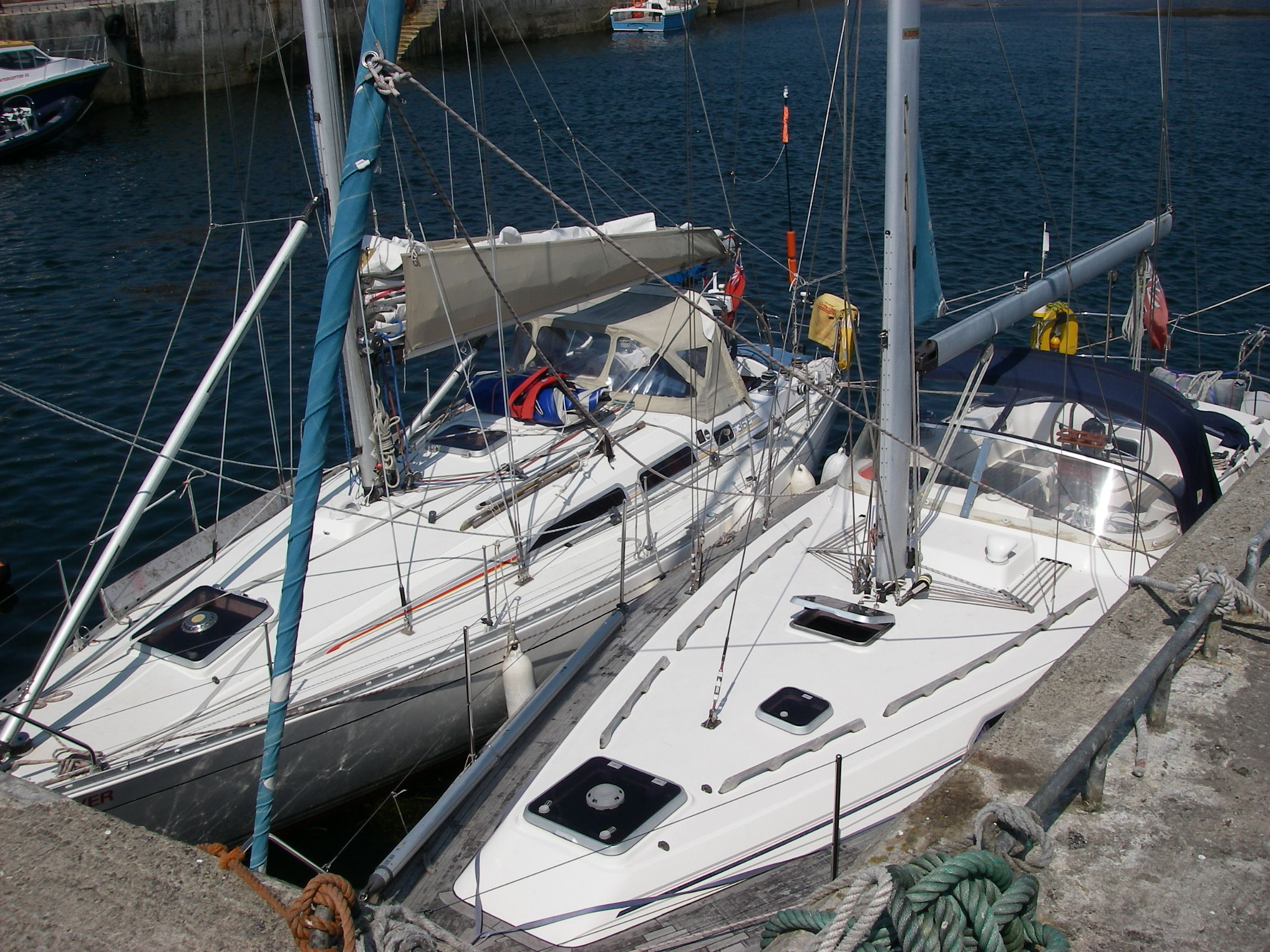
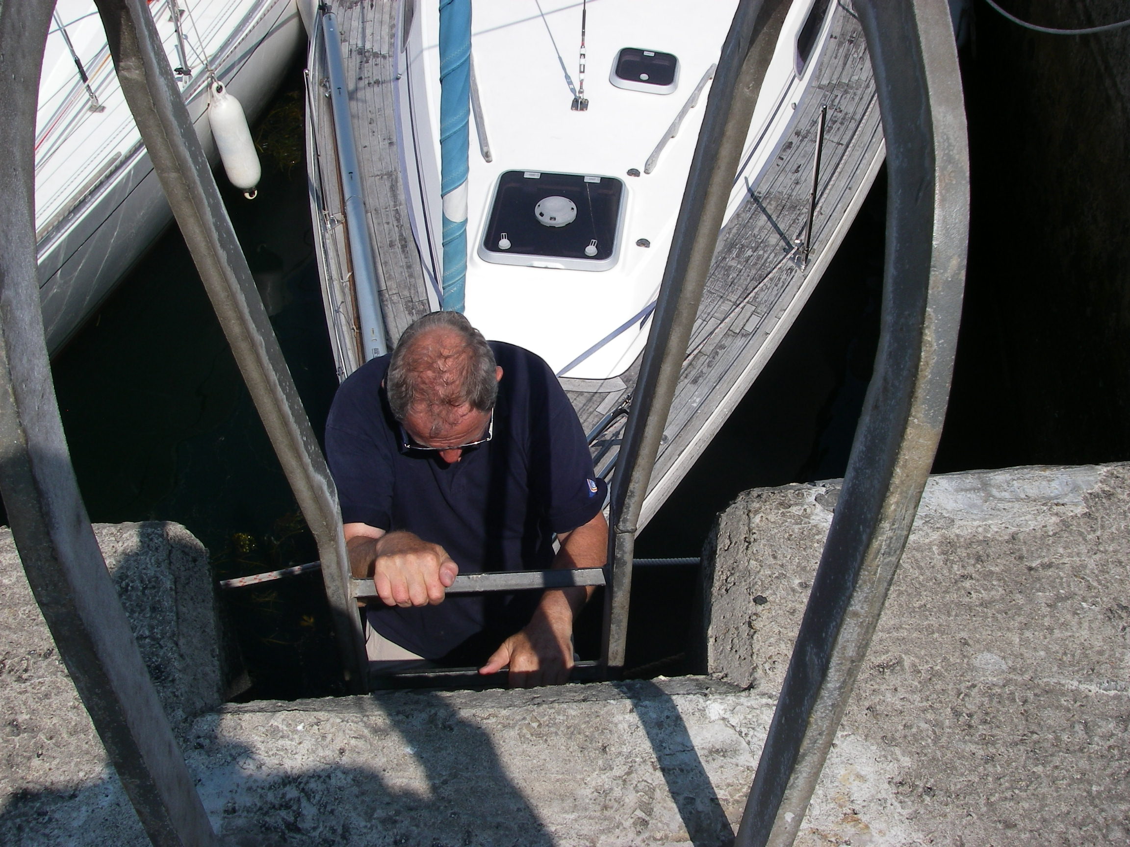
Slipped in behind the newish concrete breakwater at Tory Island, rafted against another yacht, bows to the quay. We could just reach the iron ladder from Paul, our neighbour’s, bow. He was a single-hander of a certain age in a 40 foot Westerly, and pretty skilled to get in there alone.
Lunch with him in the pub – fresh chowder and soda bread – and then they let us use one of their hotel rooms for a shower (no charge – ‘just a little tip for the chambermaid.’) Bought a few groceries, an ice cream in a cafe, had a siesta in the heat.
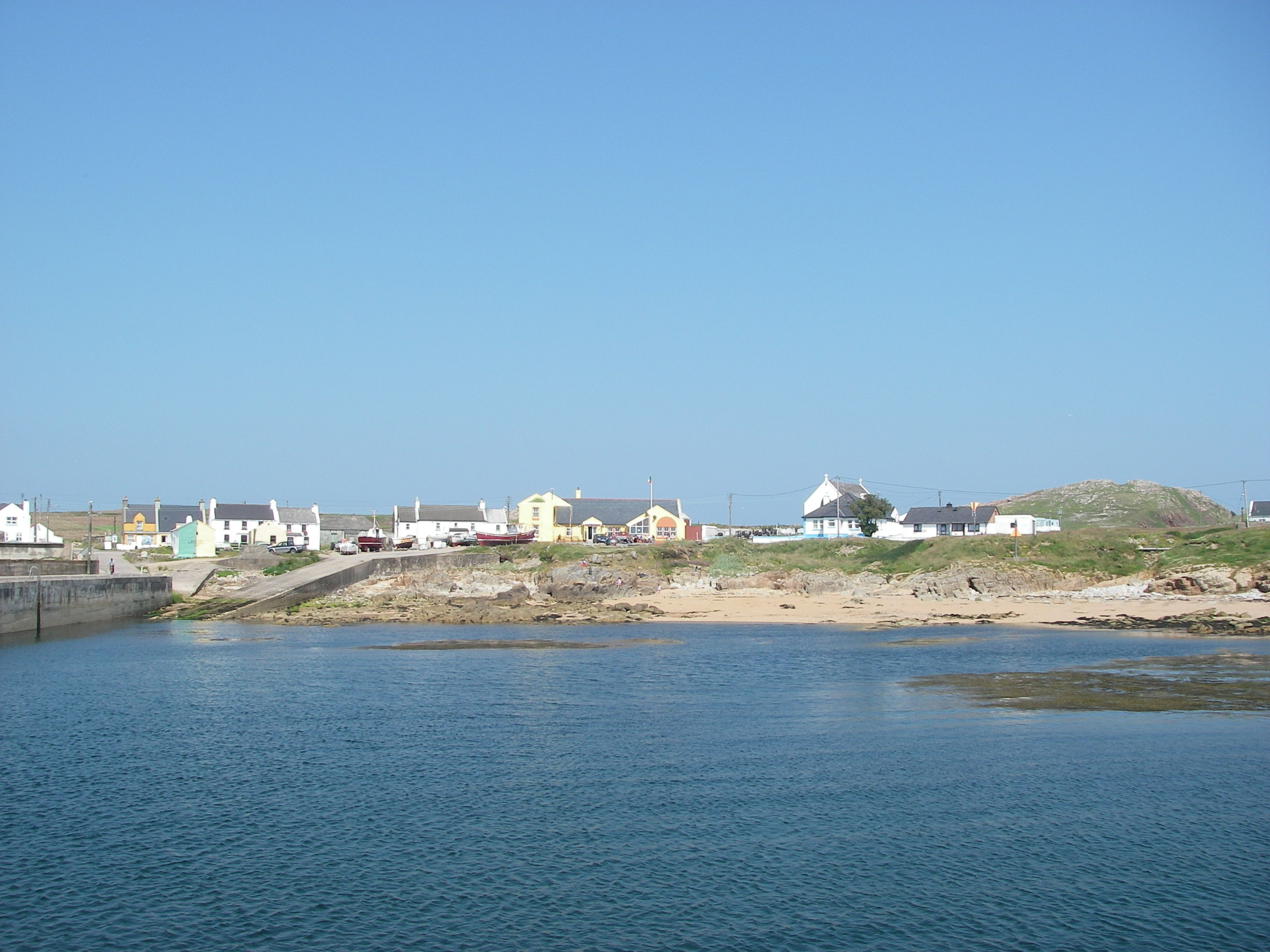
The island lived off fishing, but has now developed its tourism, and can tell a long and complex history, at least for the size of the place. Here is another link, to the official island website, which uses the Irish version of the name, Oileanthorai.
The pilot book says there are three mail boats a fortnight, but that is out of date – there is a regular and frequent ferry service to and from the mainland bringing tourists several times a day. It hasn’t undermined the friendliness, because people seemed very happy to chat.
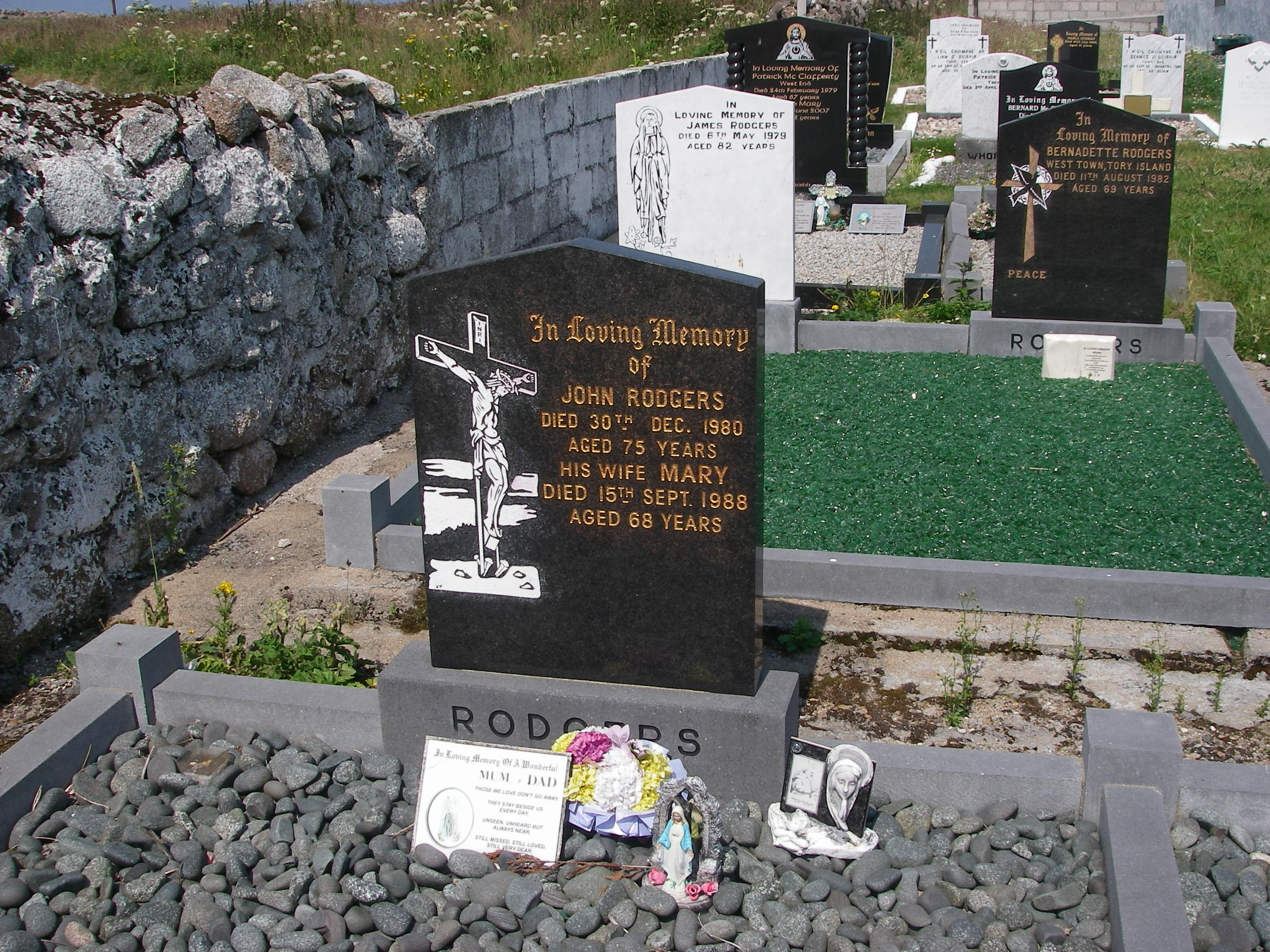
Checked out the Rodgers story. The modern graveyard by the church had three Rodgers memorials close together, including two generations of John & Mary, and several other stones around with the same name. There is another larger and older graveyard which we didn’t explore. We could see an elderly man tending a Rodgers grave, though.
The pub landlord, checking with another customer as well, said the name had been on Tory for many hundreds of years, and he thought it was Irish in origin. This tallies with an article I found that said that some Irish Rodgers came from England, but others were given it by government clerks because Rodgers was the nearest English sound to their Irish language names. Since Tory is still Irish speaking, that sounds the most likely explanation. In fact, in a tourist guidebook they called their language Gaelic rather than Irish and said it was understandable by Gaelic speakers from Islay in Scotland, 70 miles away.
The landlord slightly spoiled the simplicity of the story by speculating that Rodgers might also come from Rodrigues. The guidebook said that Tory islanders had made themselves unpopular by harbouring refugees from the Spanish Armada.
Patsy Dan Rodgers is the island’s best known inhabitant, and the islanders have given him the nickname King of Tory. He is well known locally as an artist, and works with Ruari Rodgers.
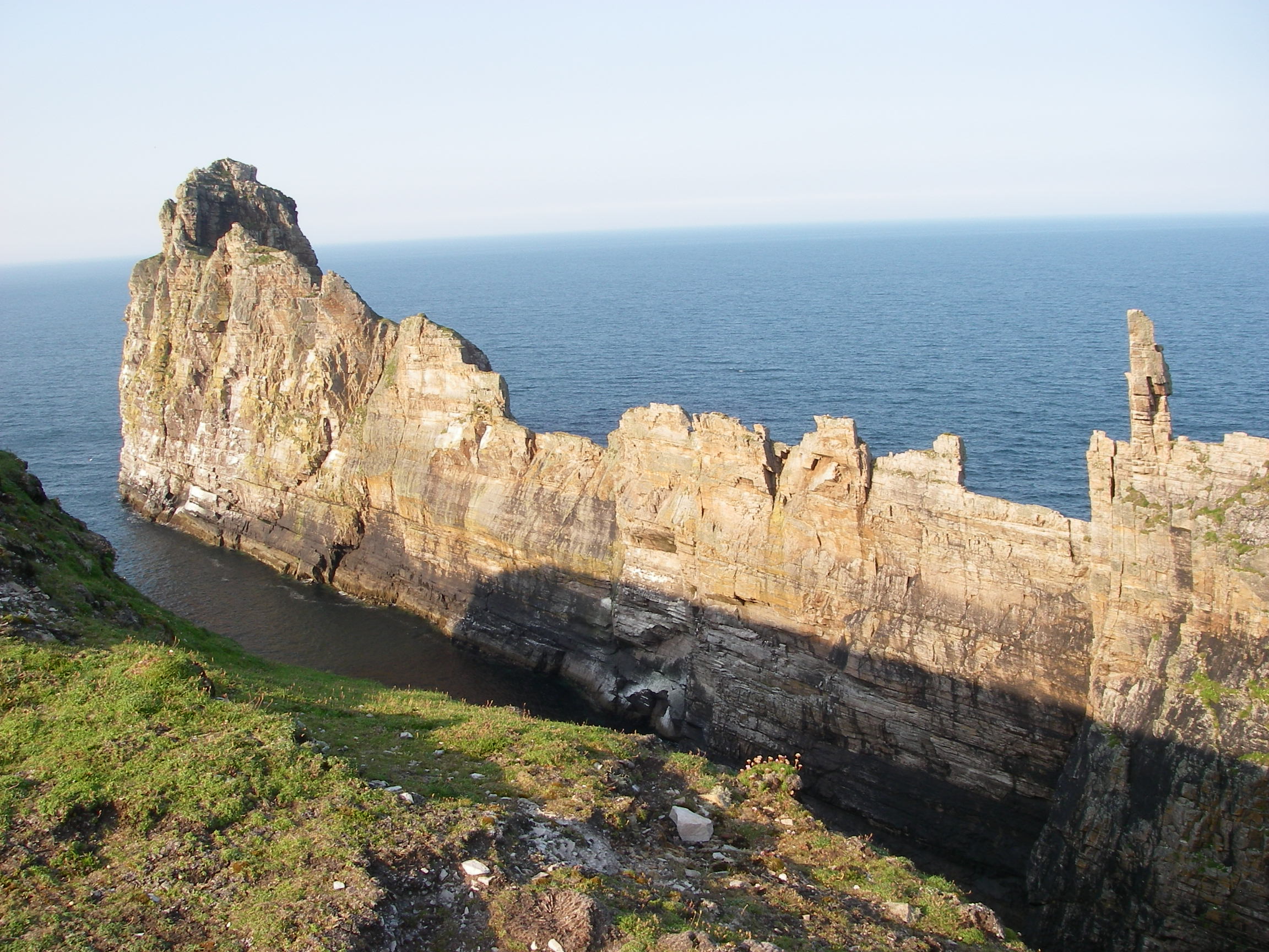
Later we walked to an Iron Age fort on a terrifying site on a narrow promontory that rose to the landward edge of a cliff. We walked past successive lines of earthworks and tumbled rocks that archaeologists had identified as buildings. The guidebook said there was disagreement whether the fort was 700 BC or first and second century BC.The last defence of these people was even more precarious, across a narrow ledge of rock with a huge drop either side. This led to a tiny area of land which tailed off into a long and impassable saw-toothed ridge. They must have been in a desperate situation if they had ever been driven into the final redoubt with only the ridge behind them.
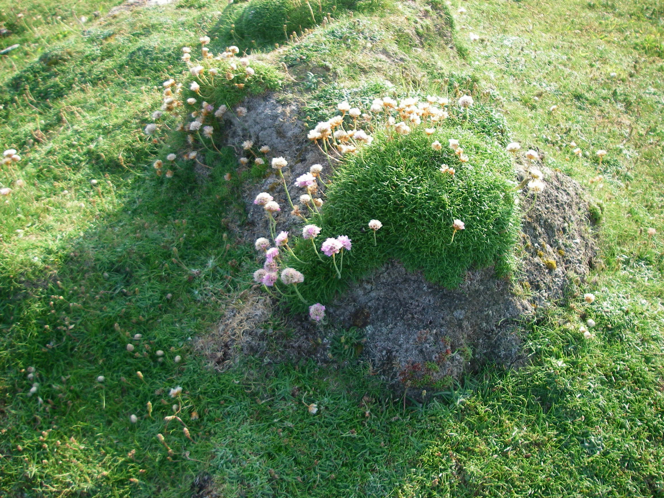
Some interesting plants on the fort, one of which (pictured below) seemed to be responsible for building up the soil on the bare rock, because quite large, round clumps of its old roots seemed to be turning into a fine humus.
Pollock and chips in the pub – always a special treat for those of us involved in the BCCI lawsuit …. no, it takes too long to explain – and a pudding of local seaweed, milk and sugar, which was delicious. A very quiet night in the shelter of the high harbour wall.
Passage notes: 28 miles, 5 hours, SE 3, clear and sunny. Little room in harbour, but space rafted up for several yachts. Some room on the inshore end of the jetty for shallower draft yachts and also alongside fishing boats. Watch out for ferry berth. No charge for yachts. Anchorage outside is very exposed.

Tory Island is in part of the clan territory of the McGinley Clan (Mag Fhionnghaile). The Rodgers family probably moved there after the Nine Years War and the ensuing upheavals (to put it mildly). The name is certainly not English or Spanish. It is Irish Mac Ruaidhridh, also known as McCrory/McRory.
Proinsias Mag Fhionnghaile
McGinley Clan Chieftain.
Thank you, very interesting to know. Transcription from Irish was one of several suggestions but from what you say that must be the right answer. The English derivation of Rodgers is from Norse via Norman French – Hrothgar, I believe, as in Beowulf, meaning something like valiant spear. It was the name given to many foot soldiers, and after the Conquest it became more associated with farm labourers etc than the aristocracy (with some famous exceptions).