How accurate is the position calculated by your smartphone? The Royal Institute of Navigation is sceptical. Its new book on electronic navigation for leisure sailors says: “At sea, mobile phone positioning uncertainty will typically be several hundred meters or more, which may be enough to put us into danger”.
I am looking for some proper studies on this issue, because I am sceptical about that statement. In the meantime it’s easy to check what your phone tells you about its own location performance when it relies only on satellite signals.
Handheld devices such as phones and tablets on land will normally use wifi and mobile phone signals to enhance position accuracy. In your phone settings, choose the button that says GPS or GNSS* signals only, to exclude wifi and phone positioning. You can then see how it performs on satellite data only.
My OMN 3 app for land navigation gives a simple accuracy measure in meters, which is derived from what the phone tells the app. It is usually defined as the radius of a circle within which are found 95% of position readings.
A reasonable rule of thumb is that a GNSS device is performing satisfactorily if this measure is 15 metres or less, but it can often be as good as 3 to 5 metres even on a smartphone. After making a couple of changes in the app settings, I can see the error number by tapping on the position icon.
Update – I should mention that in OMN3, when you put it in tracking mode, you can call up a log and set it to show the error at every trackpoint. So for checking purposes, I set the trackpoints at 25 metres apart and afterwards had a near continuous readout of the error in metres. In the latest 4 walks totalling about 25 miles, the error was most often at 4 or 6 metres, quite often at 8 metres and very occasionally at 12. It only went higher when it was left on in the house.
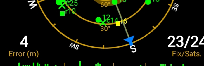
There is a more comprehensive way of checking a phone’s performance: download an app that displays satellite data. I’ve tried several but find the easiest to use are GPS Test and a free one called GPS Status. Here is a screenshot of the latter:
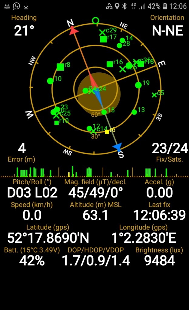
It shows the satellites in sight in diagrammatic form. Their signal strengths are in the horizontal bar, and above that to the right you can read the number being used for determining position, in this case 23 out of 24 observed (though once it gets to about 10 there is not much further increase in accuracy). Here under half the satellites being used for finding the position of my phone are GPS, the original satellite location system #.
There is a lot of other information, including two key accuracy measures:
Centre left, near the grid of the sky, is the error measure in metres mentioned above. Bottom centre are more technical measures. The one to focus on is HDoP, which means Horizontal Dilution of Precision. A number of 1.4 is regarded as good, and anything below is better. This shows 0.9 at the moment the screen shot was taken. A double figure HDoP is bad.
Offshore navigation classes always tell you that it’s important to check these measures whenever an accurate position is critical.
There’s also a much more basic and obvious way of checking GNSS accuracy. Out at sea, you do not often get a chance to double check your GNSS reading to a few metres against a known charted object. (You can do it in a harbour or when passing a buoy or some other object that it’s safe to approach, though buoy positions change tens of metres as they swing around and up and down in the tide and wind).
In contrast, on land there are many opportunities to check a phone’s location performance precisely as we pass places and objects on an Ordnance Survey map. By the time I get back to sea I certainly hope to have a much better idea of my phone’s accuracy, using both visual checks of the positions displayed on my map and the more rigorous technical data available from the apps.
Update March
Now walked about a hundred miles with accuracy log on: still almost all readings 3,4,6 and 8 metres, occasionally 12, 24 if indoors.
And another thought: the log includes lat and long and time. So if leave switched on at sea could use it as a backup to boat position log if need to check written entries. Presumably will go on tracking outside Ordnance Survey limits. To test.
*GNSS stands for Global Navigational Satellite System, and is beginning to enter general usage instead of GPS. It embraces the Russian GLONASS, Chinese BeiDou and European Galileo satellites, as well as the original US GPS system – all should be picked up by newer phones. In addition, there are regional systems that enhance accuracy by sending correction signals from the ground back through satellites and down again to the location devices we use, including phones.
# Satellites being used for a fix are shown as green. Yellow means not being used. GPS satellites are the discs, GLONASS are rectangles, BEIDOU are crosses (x) while GALILEO satellites are + signs, though at this particular moment they don’t seem to be visible. The size of the symbol depends on the signal strength received.
