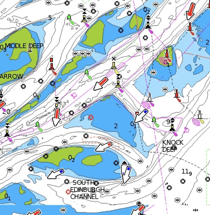
Sometimes I wonder where the Royal Yachting Association has been for the last 10 years. I have just had an email from them saying “in the next ten years or so digital will become the dominant method of navigation”. In the real world of small boats, digital has been the dominant method of navigation for at least the last 10 years.
Continue reading “RYA navigators still last in the fleet”Tag: RIN
Admiralty gives in
The revolution has been postponed: the United Kingdom Hydrographic Office has delayed the phasing out of its Admiralty paper charts for four years, to 2030. This follows pressure from the Royal Yachting Association and others.
The argument against losing paper charts sooner is that adequate electronic alternatives for small craft – especially small commercial ones – will not be ready in time.
Continue reading “Admiralty gives in”January – RYA training upheaval, and ending an electronic chart nonsense
The small craft navigation conference in Cowes at the end of January heard that the RYA is finally promising to overhaul its outdated Day Skipper and Yachtmaster shore-based courses.
The conference was also told that there is to be a concerted attempt to abolish that annoying legal disclaimer on all our electronic charts that they are “not for navigation.” As soon as we switch on a pop-up appears with this message, often with a line underneath saying that only paper charts must be used, which of course almost everybody ignores.
Continue reading “January – RYA training upheaval, and ending an electronic chart nonsense”…and a phone to steer her by
Mobiles have had a bad press as navigational tools, but if I were forced to choose one single piece of electronics to take to sea it would be my phone. That’s not a popular view among professionals.
Instructors, coastguards and rescue services learn of many cases where boat owners, especially of powerful motor yachts and RIBs, set off for the open sea with nothing beyond a chart app on a mobile phone, and no knowledge of the underlying skills needed to navigate safely. For the Royal Yachting Association, mobiles are well down the list of recommended priorities, because of the risk that they will be used badly. Textbooks give stern warnings that you must not use them for navigation.
Continue reading “…and a phone to steer her by”Satellite accuracy on a mobile
How accurate is the position calculated by your smartphone? The Royal Institute of Navigation is sceptical. Its new book on electronic navigation for leisure sailors says: “At sea, mobile phone positioning uncertainty will typically be several hundred meters or more, which may be enough to put us into danger”.
I am looking for some proper studies on this issue, because I am sceptical about that statement. In the meantime it’s easy to check what your phone tells you about its own location performance when it relies only on satellite signals.
Continue reading “Satellite accuracy on a mobile”February – averting satellite disaster
The British government turns out to have been ahead of the game on the satellite risks I mentioned last month, with a £36 million programme just announced to prevent navigational satellite failures damaging the economy by as much as £1 billion a day. It is feared that the entire country has become over-dependent on a handful of satellite systems.
Emergency services, the energy grid, mobile phones, Satnav, broadcasting and other communications, the Stock Exchange and an array of other activities all rely heavily on the super-accurate timing provided now by navigational satellites such as GPS and similar systems. There are life-threatening risks from failure, says the government. An image of a third generation Lockheed Martin GPS satellite
The new investment is in a National Timing Centre to create a network of super-accurate atomic clocks around the UK, accessed through ground-based communications, so that the economy will no longer be over-reliant on timing from GNSS signals from the sky.
GNSS is the term that embraces the US GPS, the first system, Russia’s GLONASS satellites, Europe’s new Galileo and also a rapidly developing Chinese system.
Galileo failed completely for a while last year during its start up phase, because of operator errors, and there are now many examples of interference with GNSS systems and malicious ‘spoofing’, in which navigation instruments are fooled into thinking they are somewhere else. The heart of all navigation by satellite is accurate timing, without which positions cannot be fixed.


