The small craft navigation conference in Cowes at the end of January heard that the RYA is finally promising to overhaul its outdated Day Skipper and Yachtmaster shore-based courses.
The conference was also told that there is to be a concerted attempt to abolish that annoying legal disclaimer on all our electronic charts that they are “not for navigation.” As soon as we switch on a pop-up appears with this message, often with a line underneath saying that only paper charts must be used, which of course almost everybody ignores.
First, the RYA: any novice has noticed for years when boarding a cruising or racing boat that most navigation is electronic and paper charts are relegated to backup. Surveys of skippers have proved that.
The approach of RYA shore-based courses has been like getting into a car with full satnav, and being told not to switch it on but instead to dig out the AA road map from under the back seat.
After a 2 year gap without a manager for the Day Skipper and Yachtmaster shore-based courses, an executive has now been hired, and the promise is that course improvements will be a high priority this year. A better integration of training for electronic charting and traditional navigation is long overdue. More on that another time.
Second, that warning notice on our charts: it has become a joke, but it’s no laughing matter. It reflects some real quality and standards issues affecting leisure charts, which is why official hydrographic bodies will not licence their data to publishers unless they use the disclaimer. This is also the legal position, because under international maritime law only official charts from hydrographic offices are recognised.

That’s not a problem to worry about if you are a leisure sailor on a modest size yacht. But it is an issue for large numbers of small commercial vessels, including fishing boats and indeed for sail training yachts and large private yachts.
They are all under that same restrictive legal umbrella, but they mostly ignore it and use cheap leisure electronic charts anyway, because official electronic charts and equipment are so expensive. In theory they are supposed to navigate only on paper, but the law is honoured only in the breach.
The Royal Institute of Navigation, whose small craft group organised the conference, is now leading an attempt to get something done about it.
The plan is to seek minimum standards for leisure charts and chart plotters. This would be in the hope of improving them to the point at which there can be some form of official recognition, and removal of the warning.
The RIN has involved the RYA, the Cruising Association, the Marine and Coastguard Agency, the UKHO, the Marine Accidents Board, the RNLI, chart publishers, equipment firms and various other interests. The focus is a new Pleasure Vessel Navigation Systems Working Group, reporting to the UK Safety of Navigation Committee, which is under the MCA.
There is no plan to set detailed specifications – attempts to do that for the fishing industry in the UK and similar projects in Denmark and Italy failed. Instead, standards would be developed setting out what the charts should do and the functions equipment must contain in order to be approved. Manufacturers and publishers would find their own way of meeting these standards.
For example, some measure of underlying accuracy should be available, as it is on official ship charts and on Admiralty paper charts, where survey age is shown. You then know if the last survey was in 1930 or thereabouts (or indeed 1849, a contributory cause to an oil rig grounding under tow in the Orkneys in 2006).
One proposal is a much simpler traffic light system, with the colours related to the reliability of the information, including survey date.
Other issues include clear separation between crowd-sourced feedback and more rigorous survey information, which are in danger of getting mixed up in some chart brands.
Updating should also be reliable and easy. Shore features should be shown clearly on all charts, and there should be ways of drawing bearing lines from them, measured by the navigator and plotted onto screens to give a traditional fix.
Ideally, all electronic chartplotters should have a common default method of operation so anybody can switch boats and still work the plotter. That is the case with ship electronic systems, but it’s a long way from being taken seriously by leisure chartplotter makers.
The objective is to make leisure chart standards high enough to allow that disclaimer to be removed – and while it may be asking too much for international authorities to accept it, perhaps it will be known instead as the RIN standard.
It will not be simple or quick to achieve, and there are legal obstacles, too – where would liability end up if a faulty leisure chart causes an accident? But that warning as we switch on is a technical issue of real importance.
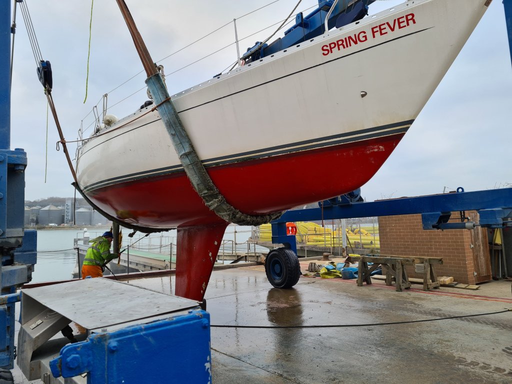
Meanwhile, on Spring Fever: We took the boat out of the water at the Kingston yard in Cowes for an insurance survey at the end of January. The boat turns out to be basically fine, but we’ve decided to preempt what will probably be an instruction from the insurance company anyway: we’ll replace the standing rigging, now in its 14th year.

One thought on “January – RYA training upheaval, and ending an electronic chart nonsense”