The British government turns out to have been ahead of the game on the satellite risks I mentioned last month, with a £36 million programme just announced to prevent navigational satellite failures damaging the economy by as much as £1 billion a day. It is feared that the entire country has become over-dependent on a handful of satellite systems.
Emergency services, the energy grid, mobile phones, Satnav, broadcasting and other communications, the Stock Exchange and an array of other activities all rely heavily on the super-accurate timing provided now by navigational satellites such as GPS and similar systems. There are life-threatening risks from failure, says the government.
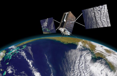
An image of a third generation Lockheed Martin GPS satellite
The new investment is in a National Timing Centre to create a network of super-accurate atomic clocks around the UK, accessed through ground-based communications, so that the economy will no longer be over-reliant on timing from GNSS signals from the sky.
GNSS is the term that embraces the US GPS, the first system, Russia’s GLONASS satellites, Europe’s new Galileo and also a rapidly developing Chinese system.
Galileo failed completely for a while last year during its start up phase, because of operator errors, and there are now many examples of interference with GNSS systems and malicious ‘spoofing’, in which navigation instruments are fooled into thinking they are somewhere else. The heart of all navigation by satellite is accurate timing, without which positions cannot be fixed.
Category: All about navigation
January – satellite scares, and getting ready for Biscay
At the Royal Institute of Navigation’s small boat conference in Lymington earlier this month, I learnt a lot about new risks of error in satellite navigation : I did not know, for example, that it is possible with quite cheap local equipment to fool the GPS on a plane, ship or even a missile into thinking it is somewhere other than its real position.
There are now tens of thousands of reported incidents of errors, deliberate, accidental or of unknown cause, with a substantial number of them unsurprisingly in sensitive areas such as the Gulf, and the Black Sea near Ukraine, suspected to be hostile activity.
Reports of accidental errors include a couple of local failures when US naval vessels arrived in the port of San Diego, apparently forgetting to switch off unspecified electronic equipment, which interfered with satellite-derived positions for miles around.
Is your chart relying on an 1860 survey?
Footnote to cruising the Scillies: piloting there is a reminder of the importance of proper Admiralty charts, because they show the age of the surveys on which they are based, unlike any of the proprietary ‘vector’ charts available on chartplotters.
The Scillies is a mixed area from this point of view. Some of the surveys of the area were last done in 1860 – 1904 by lead line, probably from boats carried on naval survey ships and rowed up and down in straight lines quite a long way apart, so rocks could easily be missed. Other parts of the islands were surveyed at a range of different dates in the 20th century. Continue reading “Is your chart relying on an 1860 survey?”
Philosopher of sailing
The letter below was published in Cruising magazine this month:
If it does not prompt a few cross letters from traditionalists Continue reading “Philosopher of sailing”
Sunk by Red Funnel
This is what’s left of a 32 foot yacht that was cut in two at the weekend by Red Falcon, one of the Red Funnel car ferries to the Isle of Wight. Continue reading “Sunk by Red Funnel”
Compasses and sextants obsolete?
I like this passage in the latest book by Daniel C Dennett, a celebrated philosopher and writer about cognitive science who specialises in the evolution of the mind: Continue reading “Compasses and sextants obsolete?”
Chart errors (contd).
Several earlier posts covered inaccuracies in charts. Last week I came across yet another example in Cala de Portinax, a bay at the north end of Ibiza in the Balearics. This screen shot from my Navionics chart shows depths in a fair amount of detail: yet the numbers were wrong by a factor of three or four. Because of the modest depths shown, we motored in with great trepidation in Olivia Jane, a Beneteau 43 with a 2 metre draft. Yet we found the depths in the middle of the bay were all in the 11-13 metre range and even close in to the rocky shore we anchored in 8 metres. In contrast, the C-Map chart on the cockpit plotter gave no depths at all inside the bay, which is a safer option than mistaken information. We’ve fed this back to Navionics and await a reply, but the nagging question will always remain in future, even if this proves to be a rare mistake: can we trust the inshore information on these charts? What if the mistake had been the other way, showing 11 metres when only 2 metres was there? Do other brands of charts have similar errors? Continue reading “Chart errors (contd).”
PS on the National Maritime Museum
Tip for nautical parents and grandparents: great new facility opened this week at the National Maritime Museum in Greenwich – a new play area for children complete with pirate dressing up clothes and lots of games for two years old and upwards, plus a large buggy parking area. Makes a visit to the nautical collections fun for every age. Child approval rating in our test this week was 100 per cent.
Maskelyne v Harrison – the longitude show in London
We finally managed to take in the excellent Ships, Clocks and Stars exhibition at the National Maritime Museum, Greenwich, which runs only until 4 January. Among other things, it puts the record somewhat straighter on the eminent 18th century Astronomer Royal, Nevil Maskelyne, chief villain of Dava Sobel’s best selling nautical history of the race to measure longitude at sea. Maskelyne was the man who conspired against John Harrison, the genius who built the first true chronometer, or so the narrative goes in Sobel’s book, Longitude.
Not so, it is clear from the detailed story set out in the exhibition, Continue reading “Maskelyne v Harrison – the longitude show in London”
Charts, pilots, weather – Scotland, West of Ireland to Scillies
The cost of a portfolio of paper charts for the British Isles is enormous, so we ignored advice in magazine articles and pilot books to stock up on large scale charts and relied mainly on electronics. (See this link to earlier posts: electronic navigation ).
We have:
C-Map NW Europe – chartplotter.
Memory Map UK and Ireland – laptop.
Navionics UK and Holland, including Ireland – iPhone.
Antares, Bob Bradshaw’s ultra large scale inshore charts for West of Scotland – laptop. (We tried them out in some very tight little anchorages, and they seemed very accurate). Continue reading “Charts, pilots, weather – Scotland, West of Ireland to Scillies”
Marine survey accuracy
Data published by the International Hydrographic Organisation shows up a surprising fact: the UK and Ireland are below Turkey in the league table of survey quality by area of national waters. Spain, Portugal and France score much higher than the UK. Continue reading “Marine survey accuracy”
Med charter disaster?
Since looking into chart accuracy following the Orkney cruise (see previous article) I’ve spent a couple of months in the Mediterranean. It’s much worse there.
I vaguely knew that, but previous sailing in the Mediterranean had been without chartplotters and on the earliest occasions without GPS. More recently, chartplotters seem to be standard on charter boats as well as private yachts. We amused ourselves by doing some checking. Continue reading “Med charter disaster?”
Orkney Roulette
Not long after a jack-up rig called Octopus ran aground in Stronsay Firth in the Orkneys in 2006, we were feeling our way into a bay at nearby Stronsay. We crept through shoals and reefs relying on chartplotter and echo sounder, in strong winds and bad visibility, confident that our plotter would get us through: after all, we had checked it frequently on our passage up the English and Irish coasts and through the Hebrides, and had been pleasantly surprised never to find the GPS positions more than 50 metres out on the chart.
So confident had we become in our first chartplotter that a few days earlier, in fog rolling off the island of Hoy so thick that the boat’s bow was only just visible, we used it, along with the depth sounder, to find our way at dusk into the harbour of Stromness, which involves a tight turn round a reef at a point where the tide can run at up to 8 knots into Scapa Flow, right across the entrance to the inlet leading to the town.
If only we had known more about the quality of the local charts ….. much later, I came across a Marine Accident Investigations Branch report on the grounding of the jack-up rig Octopus, under tow by the tug Harald, which popped up in a web search for something else. (MAIB Report 18 2007).
How to mimic big ship equipment
To cut back seriously on paper charts, the greater vulnerability of equipment on a small craft to accidental damage would have to be taken into account, including lightning strikes. For small boats it is already possible to buy, at a price, extremely robust electronic systems, including waterproof laptops that withstand impacts (costing several thousand pounds), and high capacity lithium battery back-up packs; small back-up generators have also become cheaper in recent years and can be accommodated on many mid-sized cruising yachts.
At a cost, robust weather and shockproof electronic navigation with reliable backup systems should therefore be quite close to achievable now on a yacht. Even if we fall well short of the rigorous standards of an ECDIS system, we will not be carrying 100,000 tonnes of crude oil or thousands of containers, so perhaps we can be allowed to be rather less tough on the backup specifications. Similarly with training: new courses may be necessary, but perhaps not the 40 hours plus specified for ECDIS for commercial ship deck officers.
Continue reading “How to mimic big ship equipment”
Paper-free chart tables
The idea of a paperless chart table is usually dismissed out of hand, and the very suggestion makes some old hands fume. But if a 100,000 ton bulk carrier can now be paperless, then it is hard to maintain that it will always be a mad idea for experienced yacht owners.